Wapiti Campground
Full SunJasper National Park · Alberta, Canada · 1070 m elevation · Check-in 2:00 PM · Check-out 11:00 AM
Year-round campground on the Athabasca River bank, 4 km from Jasper townsite.
Shade reality: The 2024 Jasper wildfire burned much of the surrounding forest — expect open, exposed sites and strong midday sun.
Post-wildfire — tree shade not counted. The 2024 Jasper fire changed the tree cover here, and our canopy data predates it. These sun windows come from terrain alone, so treat them as the most sun a site could get. Surviving trees may give more shade than shown; burned ones give none.
Individual sites · 364 mapped
Site positions come from Parks Canada open data (via OpenStreetMap); per-site shade ratings aren't published — use the sun rays and terrain shadows instead. Click any dot on the map for site details; zoom in to see site numbers.
Shadiest sites on 2026-08-03 (least direct sun)
Precomputed estimate for the 15th of this month — all 364 sites, terrain + tree canopy (ETH 10 m, 2020) included.
Find a site
Official campground map362 sites
Cross-check site numbers against the park's own map before you book.
Loops AA and A–F are unserviced; loop FF (northeast, closest to the river) has electrical sites. Registration is at the southeast entrance off Icefields Parkway (Hwy 93); the Athabasca River runs along the east side.
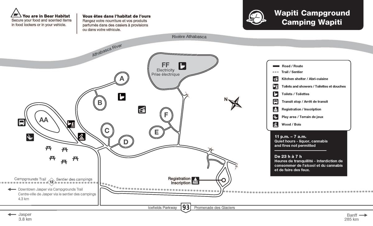
Source: official park map. Compare the loop layout with the satellite view above — north on the official map may not point up.